
Tongariro Alpine Crossing in New Zealand has got to be one of the most fabulous one day walks in the world! The entire walk is 19,4 km long and will take you through lava landscape and volcanic rock formations via the edge of active volcanoes to golden grassland, hot spring to end up rainforest-like conditions. It’s it by all standards a spectacular walk!
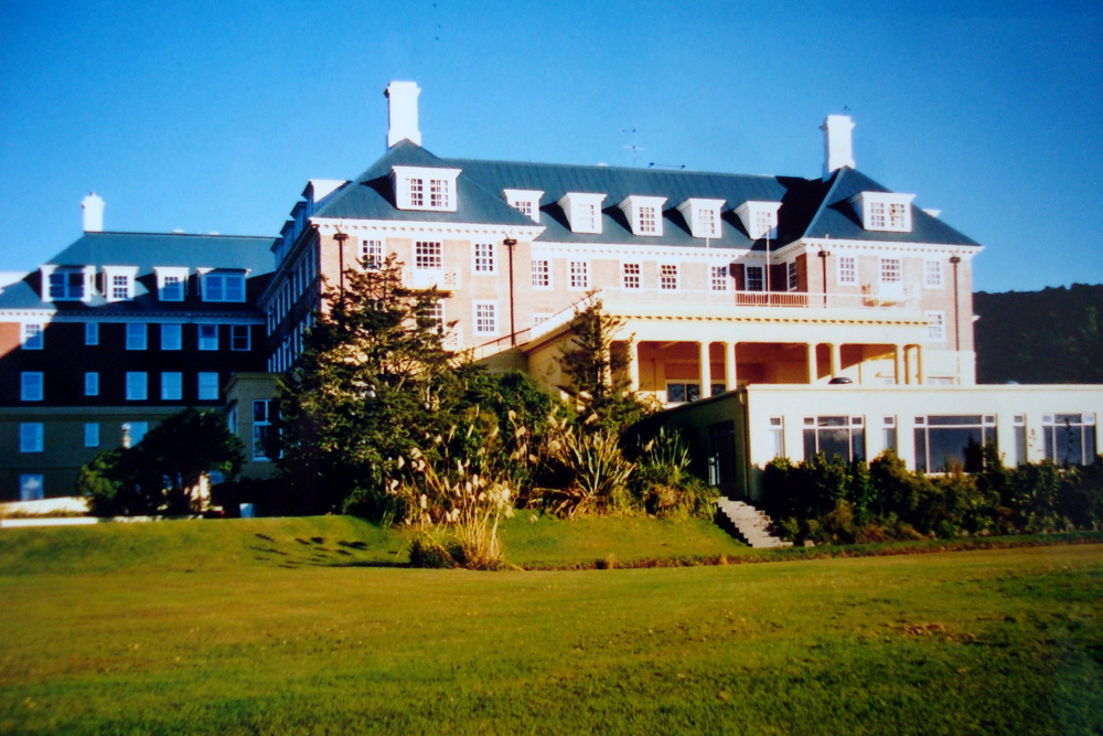
The day I arrived at Chateau Tongariro Hotel (which is – by the way – the ONLY place to stay in the nationalpark if you ask me) it was foggy. I couldn’t see a thing. No volcanoes. No nothing. Just grey/white fog. I checked in and settled in my room. I always look through those little information leaflets that tell you about services of the hotel. Under L this leaflet mentioned what to do in case of a lahar….. For those of you who (like myself before my stay here….) don’t know what a lahar is, it’s the mudflow a volcano about to erupt will throw up. Lahar’s can – apparently – be tricky…. You never know which way they’ll go. They’re likely to seek towards lower ground – but in which direction? In case of a lahar it’s therefore advised that you seek to higher grounds – like the roof of your hotel. I texted the other the half just in case….
The plan was to walk the entire Tongariro Alpine Crossing the next day but to be honest I didn’t have high hopes. Coming from Denmark I should have known never to trust the weather – the next day I woke up to sunshine and a clear blue sky! The trek was on!
I was travelling by myself so I’d booked a guided tour. We set off in a small group well equipped with water, lunch and loads of snacks.
Mangatepopo Car Park to Soda Springs
The first part of the trek is easy. It’s flat and often board walked.
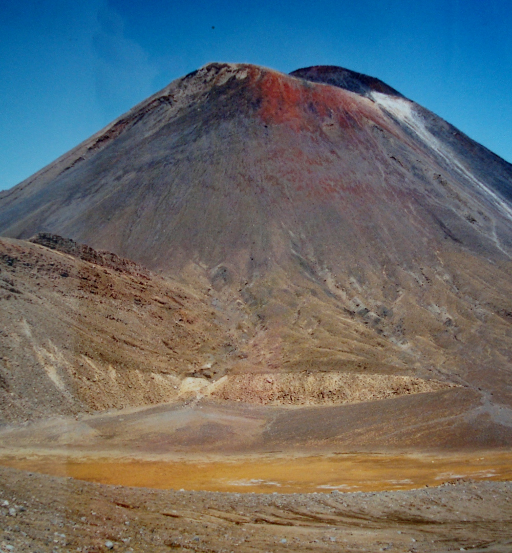
This it the part where you think: this is going to be a nice day and Oh; that’s Mt Doom!
Soda Springs to South Crater
Now the trek becomes harder. You climb from about 1400 to 1600 meters above sea level crossing Mangatepopo Saddle. If you’re reasonable fit the climbing isn’t the worst part. It’s the surface. You walk on lava flows and you really have to watch your steps.
On this part you think: Oh, no. I’m already tired. But LOOK at that VIEW!
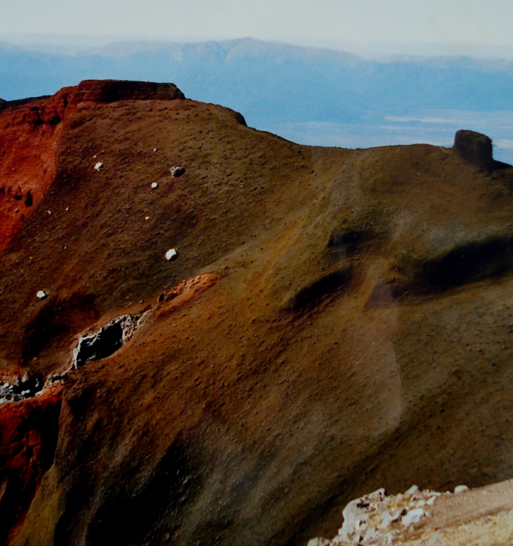
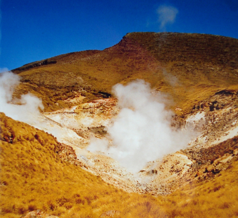
South Crater to Red Crater
Another steep climb to Red Crater. It’s slippery and by now you can smell the sulphur. When we got to this point we had lunch. The guide took my hand and buried it in the sand. It was hot. And the further down my hand got – the warmer it was. I look at the guide – half-asking – half-stating; this is not the sun doing this, is it? He just shook his head….
Here’s where you think: yeah; downhill from now on (Red Crater is the highest point)!
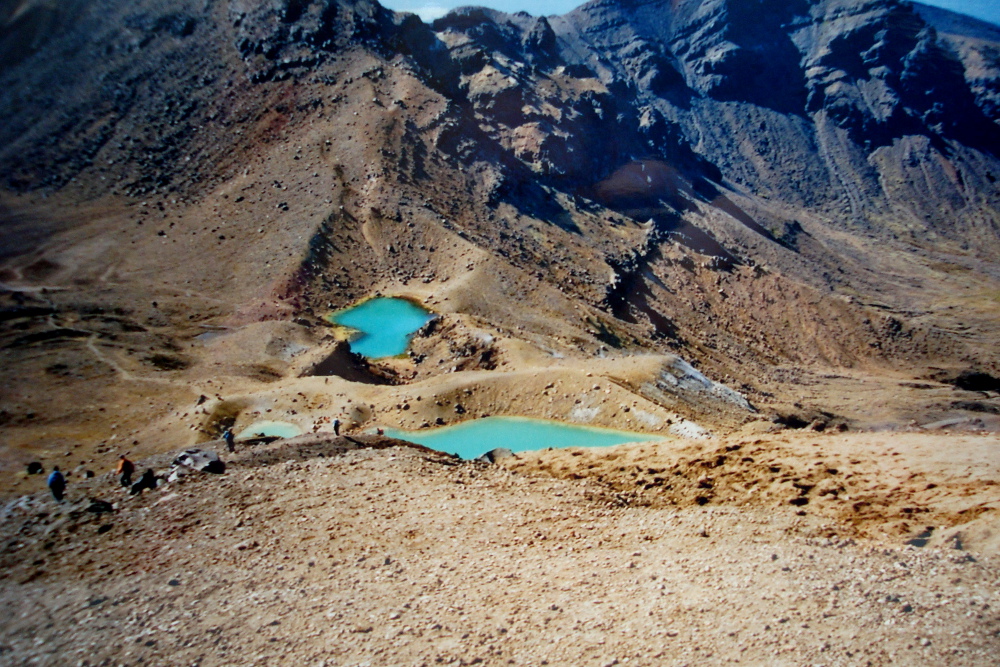
Red Crater to Emerald Lakes
This is easy. Loose terrain – but the views are to die for.
You think: this is what life is all about!
Blue Lake to Ketetahi Hut
You start the descend and cross the central crater which makes you think of the moon. Barren landscape. The you start zigzagging your way down towards Ketetahi Huts. You’ve just walked from the moon to golden grassland and warm springs. It’s a completely different world!
This is the part where your think: I actually prefer uphill. Do I still have knees???
Ketetahi Hut to Ketetahi Car Park
This is weird. You’re now in a forest. It’s dripping everywhere. And you can hear birds.
And you think: so this is what it’s all about.
That’s why Tongariro Alpine Crossing is one of the best one day walks in the world!
If you want to know more check out Department of Conservation’s website: